Showing posts with label history. Show all posts

Sunday, May 31, 2009

Where is The Digital?


Digging into the Where archive, I found Brendan asking himself:

As the internet becomes increasingly ubiquitous and reality moves toward the virtual, the emergent Cyberspace will almost certainly take on an urban form -- though it remains to be seen whether it will lean more heavily on the physical or virtual world. Either way, geography will become less and less binding as cities learn to connect in ever more complex ways, and we will likely come to understand urbanism as something very different from what it is now.

Only a couple of years later, we're already there. Maybe it's time we started thinking of ways to answer these questions. Here go my two cents:

1. Marshall Berman's All That is Solid Melts Into Air is a double ode to Modernism and The Street. The Modernist Canon includes Dostoyevsky and Joyce, of course, but also Jane Jacobs. Urban vitality is supposed to culminate Modernism. Despite Jacobs and her followers (sometimes because of them), today The Street keeps loosing ground, through stale, celebratory urbanities. The Street is not only displaced or attacked anymore; it is manicured, mercantilized, neutered, over-regulated. Today, The Street is no longer The Street. The Street is The Web.

2. The Web has not only added to Modernist/Urban Canon. It is constantly reworking and dissolving it. The Web Canon is nothing like the usual Canon. The Web Canon is not about authorship. It is about the dissolution of Authorship, swaying back to a wilder communal mode or spirit (or rather a bunch of different communal modes and spirits bumping against each other constantly). (This is one of those eras of cultural dispersion we're entering, like the days of oral tradition or pamphleteering or independent broadcasting). What is Canon one day is forgotten the next. Some Canon never makes the cut, until it does. The Canon swallows every Canon before it. The Canon is The Web itself.

3. Anything cyber — cyberspace, cyberpunk, etc — reeks of Future Anterior and has a bit of that nostalgic (conservative) retraction from reality, even when dreaming up alternative realities. Incursions into cyber-whatever (Second Life urbanisms, virtual reality, etc.) are as much the future of The Web as digital renderings, parametric design and Dubai are the future of architecture and urbanism. Depending on where you stand, this means either everything or close to nothing.

4. Even when embracing and exploiting and dwelling on The Digital, any Networked Urbanism should recognize itself as deeply entrenched in everyday, physical, political, social and cultural realities. It should also acknowledge that it has significant, explicit, lasting effects on these realities.

5. I don't think geography has become "less binding". On the contrary, it's probably only starting to reveal its complexities. This is a matter not only of physical geography or distance we're talking about, but also of political and cultural geographies and distances.

6. The Web Canon might seem Western, but it's definitely not.

7. In one of the hundreds of Web Canon Classics (someone should start collecting them), Kevin Kelly discusses the production and spreading of digital content. He states that the impact of digitization will likely be most significant not in the Developed World (despite the abundance of resources, technical knick-knacks and gadgetry) but in the Third World, in areas that are practically bookless, or at least don't have an Amazon branch.

Something similar might happen with Networked Urbanisms. In the Developed World, Networked Urbanisms' potential might very well fade out under the weight of control and commercialization. The Kindle and the iPhone are the McMansions of Digital Urbanity. Networked Urbanisms could certainly profit from the chronic instability, forced flexibility, selective implementation, DIY and everything-up-for-grabs mindset, creative reuse and living-off-scraps culture of Third World urban realities as much as it already does from its pools of skilled tech workers, cheap manufacturing and shady practices like piracy and copyright infringements. The “digital breach” doesn’t necessarily follow the North-South divide.

8. The Plaza Meave is a huge semi-formal electronics bazaar in the heart of Mexico City’s Centro Histórico, or Historic Quarter. It’s a piece of urban infrastructure straight out of Sci-Fi: an anonymous, damp, smelly and seemingly innocuous building where people hawk and hustle pirated software, stolen or scavenged electronics, tuned hardware, abandonware, orphaned technology, and any random techno-spoils you can imagine. The market often spills over onto the street, and the tech stands mix in with food stalls.

9. I hate the “digital skin” metaphor. There is no such thing as an ICT blanket that just comes and covers or supplants “traditional” urban dynamics. If you’re going to use the usual cheap organicist metaphor, why not say “digital lymphatic system” or something like that?

10. Most of us are too quick to associate technological change with the brave and the new. But to me, one of the most interesting aspects of the digital onslaught is the novelty with which it feeds the past into the present and therefore the future. The Digital has an uncanny historical bent. It allows for and thrives on richer, more intense and diverse readings of the past. We are unburying the marginal, the secondary, the almost forgotten, the populist, the failed, the ephemeral, the quaint, the curious, the quotidian, the small, the foreign, the frilled, and so on and so forth, and inserting everything into our steady and active forward marches. The Angel of History doesn’t have to fly with its back turned to the future anymore. It can just gaze at the past on its iPod.


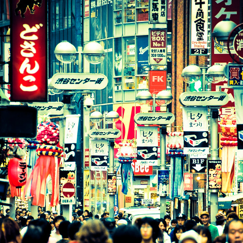
(I don't remember if I got the photo from Flickr or from Mark the Cobrasnake. If it's your's, please let me know!)

Sunday, April 27, 2008

Urbanffffinds 027

Apologies for the lack of Urbanffffinds last week. This week, please accept this double-shot of urban imagery goodness as a peace offering. And some more happy news: part-time employment has been secured, and regular posting will resume at Where, starting with almost three weeks of great arch&urb stuff in a hearty linkdump, tomorrow morning.


Tuesday, November 20, 2007

National Geographic's Maps: Tools for Adventure @ the Museum of Science and Industry

If you typed the word "maps" into Google and then visited the first ten sites on the results page, you might get a good idea of what it feels like to walk through the Museum of Science and Industry's exhibit National Geographic's Maps: Tools for Adventure, which is part of the citywide Festival of Maps. That is to say: a nuanced overview of mapping technology, this is not. While the exhibit is kid-friendly, it tries a bit too hard to go after the attention deficit demographic. Thematically, the "tools for adventure" theme is the loose string that sort of ties things somewhat together, almost. In fact, between this, the City of the Future exhibit earlier this year, and the Christmas Around the World disaster that we'll discuss in a minute, I'm beginning to wonder if, perhaps, this legendary museum is just coasting on its historical reputation these days.

But, before a tangent begins, let's get back to NGM. The exhibit is, in plain terms, an awkward hybrid of a video arcade, a preschool classroom, and a museum installation. There are kiosks set up throughout several rooms, as well as a block table (a kid-friendly trick MS&I tried with City of the Future that still feels misplaced) and a large foam-block pyramid puzzle. Add to that a moon rover used for mapping Mars, a fake stargazing setup, and an airplane cockpit with plenty of buttons and levers, and you have an intellectual seizure that can even make the grown-ups a bit dizzy.

If the organization of the content is less than stellar, it should be noted that there are some interesting items on display. A portion of an old scroll map of the Mississippi River makes an early appearance, as does an early map of Disneyland (which is cooler than it sounds). But the overall effect of the topical schizophrenia is that, unfortunately, individual pieces get lost in the muddle. Even for someone used to clicking through a few hundred articles and websites a day, the wide variety of topics covered here was so overwhelming that it got downright boring halfway through. When the brain is presented with too much information, it shuts down. I shudder to think that this is the way the curators at one of the nation's most prestigious museums think that children should be taught (to be fair, the exhibit was organized by the Children's Museum of Indianapolis and the National Geographic Society, but MS&I agreed to host it).

But the real jaw-dropper of the day was not the FoM exhibit, but something tangentially related. Apparently, it is customary for the MS&I to put together a Christmas Around the World exhibit. I haven't been to the museum to see past iterations, but this year the exhibit involves Christmas trees decorated to represent "customs" from countries around the world. This provides the museum with a fabulous opportunity to combat Americans' infamously low geographic knowledge, which it squanders on an embarrassingly simplified version of global cultures.

To wit: Mexico's tree is decorated with dozens of felt-cutout Mexicans complete with sombreros and ponchos, Ireland's is dripping with kitschy shamrocks and jigging leprechauns, and there is a very purple Native American Christmas tree that's decked out in a gazillion of those hexagonal things you make out of yarn in kindergarten. Japan's and China's trees, meanwhile, are both covered in oragami (but the China tree uses fluorescent paper, so it's totally different), and (tellingly) the United States' tree is wrapped in red, white, and blue crepe paper and cardboard cutouts of the 50 states and the US outlying territories. It's as strange as it sounds. In fact, it's worse in person. The entire exhibit has the icky, sticky feeling that comes from seeing or hearing something that you don't quite want to call racist, but can't help admitting is kind of leaning in a generally gross direction. The museum's website claims that the trees are decorated by Chicago's ethnic groups to represent their cultures. And to that I say: whaaaa? If that's the case with most of these, it makes me kind of sad.

So if you are looking to learn about the world and how it was and is shaped and explored, skip the MS&I and check out the Field Museum instead. Or the Newberry Library. Or, you know...Google Maps.

But, just in case you want to see this stuff for yourself...

IF YOU GO
National Geographic's Maps: Tools for Adventure is on display at the Museum of Science and Industry until January 6, 2008. The museum is open Monday – Saturday from 9:30 a.m. to 4 p.m, and Sunday from 11 a.m. to 4 p.m.; the admission fee is $11 for adults, $9.50 for seniors, and $7 for children under 11. There is no student discount. Christmas Around the World also runs through January 6. While you're in the Hyde Park area, check out The Virtual Tourist in Renaissance Rome: The Speculum Romanae Magnificentiae, the University of Chicago's contribution to the Festival of Maps.


Links:
National Geographic's Maps: Tools for Adventure (MS&I)

Christmas Around the World (MS&I)

The Virtual Tourist in Renaissance Rome: The Speculum Romanae Magnificentiae (U of C)

Festival of Maps

Monday, November 12, 2007

Mapping Manifest Destiny @ The Newberry Library

From a curatorial standpoint, Mapping Manifest Destiny at the Newberry Library (which is in a gorgeous building, in case you were wondering) is an excellent exhibit. The gallery space where the maps are displayed is large and quiet, and the information is carefully organized into four color-coded areas that chart the history of the North American West through cartography. The four sections illustrate the progression of the continent from exotic terra nova at the edge of the world to civilized nation linked by a sophisticated network of railroads by defining the primary focus of mapmaking in four different eras of exploration. You can basically watch the centuries-long process of the formation of the United States (and Canada and Mexico, to lesser extents) take place in under an hour. In addition, scale is provided by the inclusion of maps that detail Chicago's own growth from a swampy outpost into a major transportation hub for the rapidly-growing nation. It's downright artful curation.

Oh, and the content is pretty good, too. ;-)

In fact, the collection is a perfect illustration of the fourth use of maps as explained by the Field Museum's Festival of Maps exhibit: these are maps that "bear witness to and shape history." The first two sections, which explore Maps for Empire and Maps to Serve the New Empire show the evolution of the shape of North America as ever more sophisticated cartographical methods and new knowledge about the continent became available over time. Centuries-old European maps are on hand, as are some of the earliest maps of several modern major American cities, such as San Antonio, New Orleans, and Pittsburgh (the last one being drawn and annotated by none other than the young George Washington).

Halfway through you'll find a real treat: William Clark's (of Lewis & Clark fame) original, hand-drawn map of the Corps of Discovery's exploration of the American West in search of an overland river route to the Pacific. The edges are frayed and the ink slightly faded, but this is history, staring you in the face. It almost glows; it gave me goosebumps.

While the first half of Mapping Manifest Destiny shows how the land manipulated the people that explored it, the second half shows how, once the continent had been properly charted, people then manipulated the land. This half is separated into Maps for Enlightenment and Maps for Business, and details the United States' growth into a commercial juggernaut. The gridded system of land surveying that directed property sales and distribution as the US expanded westward, spurred on by the ideology from which this exhibit takes its name, shows up here. Maps for Enlightenment features see nineteenth-century text books opened to maps (my personal favorite was the one that color-coded the world on a scale from Savage to Enlightened). Maps for Business covers Chicago's rise to dominance of the field of commercial cartography. Several maps and books by Rand McNally (the company largely responsible for the Windy City's cartographical supremacy) are on display. The Business section is rounded out by maps of the expansion of the nation's railroad system and the California gold rush.

Mapping Manifest Destiny is short, sweet, and to the point. It's certainly not the kind of thing you'd bring the kids along for (especially if they're the crying type -- the ceilings are high, and everything echoes) as the material is presented in a very mature way. But anyone interested in US history (or the art of exhibit curation) will find the Newberry Library's contribution to the FoM to be a truly enlightening experience.

IF YOU GO
Mapping Manifest Destiny is on display at the Newberry Library on Chicago's Near North Side until February 16th, 2008. The library's exhibit galleries are open Monday, Friday, and Saturday from 8:15 am - 5:30 pm, and Tuesday, Wednesday, and Thursday 8:15 am- 7:30 pm; the galleries are free and open to the public. While you're there, check out Ptolemy's Geography and Renaissance Masters in the gallery across the lobby. A short bus ride down LaSalle Street is Encyclopedia Britannica's US headquarters; the building's lobby is host to a variety of maps from the Britannica collection, marking the company's contribution to the FoM.


Links:
Mapping Manifest Destiny (Newberry Library)

Ptolemy's Geography and Renaissance Masters (Newberry Library)

Encyclopedia Britannica

Festival of Maps

Sunday, November 4, 2007

Maps: Finding Our Place In the World @ The Field Museum

About a fifth of the way through the Field Museum's Maps exhibit, I started to feel a bit giddy. As a long-time lover of maps, I'd been looking forward to this -- the centerpiece of Chicago's Festival of Maps -- for months, and it was clear early in my time at the exhibit that I knew that I would not be disappointed. Now, after having a day to reflect, I can honestly (and emphatically) say that Maps: Finding Our Place in the World is one of the most impressive museum exhibits I have ever attended.

Those are strong words, I know, so let that be my one burst of enthusiasm. Henceforth, I'll try to be as objective as possible...I'd hate to do that thing where I puff something up so much that it can't live up to my description. Not that I think it's possible to overstate -- oops, sorry. Almost gushed again.

Divided into seven sections, Maps begins by addressing what is probably the most common use of its subject matter: wayfinding. The content of this section is subdivided into two groups, the Itinerary (one route depicted) and the Network (many routes depicted together). The maps on display set the tone for the rest of the exhibit; there is a great variety of mediums, styles, and time periods represented. Highlights include a section of an ancient 60-foot Japanese scroll depicting the road from Kyoto to Edo (now Tokyo), a 1940s road map of America with road trip routes taken by an anonymous family highlighted and annotated, and an original print of Harry Beck's revolutionary redesign of the London Tube map.

The second section of the exhibit displays maps that give structure to the world. While many maps may not be used directly for getting from A to B, they help us to develop a concept of the vastness of the world around us. The exhibit charts the evolution of mankind's understanding of the planet through maps, showing how they were used to record progress and redefine the world as our knowledge grew. The undisputed centerpiece of this area is a set of two large (about 4 feet in diameter, but I'm guessing) wooden globes -- one that depicts the earth as it was believed by cartographers to look (curiosities include the island of California off of North America's west coast and the near-absence of Australia and New Zealand, though overall it's surprisingly accurate) and the other showing the celestial dome above, with full-color representations (i.e. a scorpion for Scorpio) of the constellations.

Maps are also used, as shown in the third and fourth sections of the exhibit, to show important places and "bear witness to and shape history," in the curators' words. These two collections expand quite nicely upon the logic of the first two; the most obvious uses of maps are to chart the world and the routes that people use to move around it, but with a heightened understanding of the larger world, it makes sense that people started using maps to break the larger world down into smaller parts. Privatization and land division become central foci here. Several important names pop up up in a subset of the fourth section focusing on historical maps of the US: Lewis and Clark's map of their route is here, as are land surveys by George Washington, Thomas Jefferson, Abraham Lincoln, and Benjamin Franklin.

Even more sophisticated maps make up the fifth section, which highlights maps that make the invisible visible. These are highly detailed creations that detail intangible or hidden details about places. One of Jane Adams Hull House's famous maps of Chicago blocks broken down (and color-coded) by ethnicity and income is on display (a print of the same map is included in the Chicago History Museum's Mapping Chicago exhibit). So is a huge, vividly-colored map of the geology of Great Britain, one of the first maps of its kind. Another first here is a small, unassuming map of northern Italy that is believed to be one of the first uses of shading to depict topography, pre-dating its common use in recent times by several centuries. A closer look at the plaque describing this piece reveals that its creator was none other than Leonardo da Vinci. Another of his quiet pieces, a plan to canal-ize the Arno, is nearby.

The sixth area is a showcase of maps that depict imaginary places. L. Frank Baum's map of Oz is here, along with several of J.R.R. Tolkien's hand-drawn maps of Middle Earth. This section contrasts nicely with the seventh, which shows maps in rather mundane use in everyday life. A RISK board, a needlepoint map of Great Britain, a kiosk showing mapping technology on modern cell phones -- these examples point out the many ways in which maps seep into our daily routines. This last section culminates in an interactive wall of video maps where you can touch cursors on large screens and navigate satellite imagery and zoom in on your hometown. (It can be a bit tricky to get these to work -- try holding your fingers a few centimeters away from the screen).

If there is one opportunity that is really missed here, it's that Maps does not spend any time on the way that the internet is currently democratizing the field of cartography. There is no mention of mashups or group maps or even Mapquest, the launch of which really was revolutionary moment for mapping technology (though Mapquest's prominence in online mapping has since been usurped by Google and Microsoft). In fact, I kept expecting to see this theme threaded throughout the other sections of the exhibit, but it never even made an appearance.

Overall, Maps: Finding Our Place in the World is a suitably rich and creamy center to the FoM's gourmet chocolate. It's an exhibit that keeps you moving, looking forward to the next map even before you've finished reading about the last. If you don't live in the area but you've been looking for a reason to visit Chicago, this exhibit would even make a good excuse to come. If you live within driving distance and have even a passing or newfound interest in cartography, you have no excuse not to make the trip.

IF YOU GO
Maps: Finding Our Place in the World is on display at the Field Museum until January 27th, 2008. The museum is open 9:00am-4:30pm, seven days a week; the entry fee for the museum and the special exhibit is $19 for adults, $14 for students and seniors, and $9 for children under 12.


Links:
Maps: Finding Our Place in the World (Field Museum of Natural History)

Monday, October 29, 2007

Mapping Chicago @ the Chicago History Museum

Mapping Chicago, the inaugural exhibit in the Chicago History Museum's new Skyline gallery, is also one of the inaugural exhibits in Chicago's Festival of Maps. The show, which opened near the end of September, divides the spacious new gallery into three distinct areas, each with its own theme, and shows the city of Chicago in various stages of its history, and from a variety of distinct perspectives. Overall it's a bit of a grab-bag, but certainly worth your while.

Cities are places with vast histories comprised of millions upon millions of stories stretched across hundreds (sometimes thousands) of years. As the curators of Mapping Chicago point out several times in this exhibit (most entertainingly, at one point, in the rather incredulous "voice" of the city itself) it is virtually impossible to create a map of a city that really encapsulates what Chicago is about. Buildings go up and are torn down, streets are widened or erased, demographics shift as people come and go, and all of this contributes to the fact that as soon as a map of a place as dynamic as Chicago is made, it is in some way already out of date.

The first area of the exhibit, then, attempts to piece together a historic portrait of the city. From a detailed map of the area destroyed by the Great Fire to a map of the original settlement showing the original Native American trails that crisscrossed the area, this introductory set makes no attempt to show Chicago as it is. The unofficial centerpiece here, a wall-sized full-color birds-eye view map of the Loop from the early 1900s drawn in exquisite detail, subtly underlines the show's message; of the many large and grand structures that surely seemed as permanent as time itself when this map was completed, only a few are still around today. Even monumental constructions like the old Federal Building or the Masonic Temple (then the city's tallest building) are long gone.

It's in the second area that the exhibit sags a bit as it veers rather noticeably off course to demonstrate by video and through several kid-friendly kiosks how two-dimensional maps are formed into globes. Replogle Globes, a major manufacturer of the objects, is a sponsor of the installation. This middle section is interesting in and of itself, as it answers in careful detail one of those questions that you'd never thought to ask but find yourself very curious about once it's been asked for you. Still, the section can't help feeling like a commercial in the middle of a good show since the subject matter is only tangentially (at best) connected to that of the overall exhibit. At any rate, it's fun for kids, and certainly no reason to skip Mapping Chicago altogether.

The third and final area is separated from the other two by a very unconventional map made up of a cluster of very large, very colorful representations of Chicago landmarks. It is a sculptural creation made of oversized drawings by children from around the city that sets the tone for the area of the exhibit that shows how the diverse and divergent perceptions of the city by its many inhabitants over the years has created some very interesting and unconventional maps of the city. A pinball machine printed with a map of the 1933 World's Fair, a color-coded map of building heights in the Loop in the early 20th Century, large digitally-produced maps of SOM's plan for the city's 2016 Olympic bid -- all of these and more are on display in this part of the exhibit. Together, they bring home the message that a city like Chicago is a constantly-changing thing, exciting and mysterious in the way that it constantly eludes the cartographer. The city is the subject in all of these maps, but ironically this collection, brought together, puts the focus on the map-makers. After all, in the end it is the people -- not the physical environment -- that make the city what it is at any given moment.

IF YOU GO
Mapping Chicago is on display at the Chicago History Museum until January 6th, 2008. The museum is open seven days a week; the entry fee is $14 for adults, $12 for students and seniors, and free for children under 12. Hours vary, so check the website for more details. While you're there, if you are in need of some more map action, don't miss the permanent exhibit Chicago: Crossroads of America, which features a number of detailed maps from the city's two world's fairs. Also on display: gorgeous architectural models of the Chrysler Motors and Transportation Buildings from the '33 Fair.

Links:
Mapping Chicago (Chicago History Museum)

(PS -- Where is back in business! Thanks to all of the fine people at the North Michigan Avenue Apple Store who saved my hard drive and, by extension, my sanity. They are awesome.)

Friday, October 12, 2007

WEEKEND READING: October 6-12, 2007

It's been a busy week for this blogger, so the Weekend Reading list will be a bit shorter than usual.

ITEM ONE: Part IV, aka "The World's Worst Blog," put up a public poll to determine the three Best Archiblogs of 2007. Where has been nominated. Feel free to vote for it, if you so choose. ;-)

ITEM TWO: The new issue of The Next American City features this great article about the ripple effect war causes on crime, which happens to be available online.

ITEM THREE: City of Faded Elegance points us to the new edition of the Virginia Quarterly Review, which has a ton of great content on contemporary South America.

ITEM FOUR: Aussie blog Pigs Will Fly reports on so-called Sustainability Streets. The formula is quite fun: Mulch (learn), Sow (plan), Grow (do), Harvest (teach).

ITEM FIVE: Planetizen features a great post about a new museum in Salt Lake City that focuses on the ever-changing nature of the city.

Have a great weekend!

(Photo from Flickr user LeggNet.)

Tuesday, September 11, 2007

Clarity

Generally, the only personal information you'll get about this blogger is my opinion on some urbanism-related issue. That's not to say that I take myself too seriously here; let's be real -- I'm no professional. But it seems incredibly disingenuous to write about the 9/11 terrorist attacks in any sense other than personal. It also seems odd to write about anything else today. Perhaps that's just a part of the cultural PTSD Americans are going through; we aren't haunted day in and day out, but once a year we all feel a yearning to share our stories about "that day" with each other. Even more interestingly, it's a day when most of us will actually listen to what one another have to say. At any rate, if you don't want to listen to my own account, consider this your fair warning.

And so.

I was still living in the Milwaukee area six years ago on the day of the attacks on the World Trade Center and the Pentagon. I was away when from the television when the second plane hit, as well as when the towers fell, so the most potently visual events of the day will never be as vivid for me, I don't think, as they are for many Americans. I remember what happened, but not as it happened. September 11th is, for me, a day of video replays. I saw the images a million times before September 12th, but what happened has always felt distant to me.

In fact, what I remember most vivdly from the whole ordeal came several days after September 11th. There is a massive church in the hills to the northwest of Milwaukee called Holy Hill. Perched atop -- you guessed it -- a hill, the building's two steeples dominate the rural skyline for miles in every direction. One of the towers has a public observation deck, and I traveled out to Holy Hill with two friends on the Friday after the attacks. There was no particular reason for the trip; we were bewildered by what had happened, and were perhaps looking for that musty feeling of sanctuary that religious buildings can provide.

I had been to Holy Hill once before that day with my family, and I remembered being able to see Milwaukee's stubby little skyline, over 25 miles away, enshrouded in a typical urban haze. On the Friday after the attacks, when I returned to the steepletop room with my friends, the skies were the perfect blue of early autumn, and the urban haze that had hung over the city was vanished; the air was quiet in a way that changed my understanding of that phrase. Planes had been grounded for days, of course, and as a result the view from the tower was so clear you could practically see the windows of the individual buildings in the skyline. For some reason, that image of the city stretched out at the point where the early reds and oranges of the very leafy metro area dropped off into Lake Michigan (also visible from the tower that day) has always stuck with me.

Whenever I think back on the September 11th attacks, I remember the confusion and the anxiety that followed, while the attacks themselves border on the abstract, like a never-quite-forgotten childhood nightmare. And whenever I find myself in a position now that causes me great confusion and anxiety, I use the memory I have of the view from the tower at Holy Hill to remind myself that, oftentimes, tragedy and struggle can wind up clearing things up in a way that I had never expected.

Perhaps that's too literal of an interpretation; perhaps, as many are arguing lately, enough time has passed that emotional license has revoked for people writing about September 11th, and I've just made an ass of myself by adding to the pile of endless and unncessary pontification; perhaps this post is entirely off topic and completely inappropriate. Still, I felt compelled to write it.

I live under a flight path into O'Hare, and as I write this post I can hear jets flying overhead. Most days I don't notice, but today is different.

Friday, August 3, 2007

WEEKEND READING: July 28-August 3, 2007


Ok, so...I have, like, somewhere in the neighborhood of 20 articles in my Google Reader that are basically doomsday predictions for American infrastructure. None of them will be linked to in Weekend Reading. Short list, though...

ITEM ONE: A great piece on Xanadu in the Middle East and the American dust bowl. How are they connected? Oh, just follow the link and you'll see...

ITEM TWO: Planetizen Interchange features a great post from Ali Modarres about the severe abuse of the word "community" in contemporary planning and architecture.

ITEM THREE: The world is shrinking, y'all. Or it's going to soon, anyway.

ITEM FOUR: There are two great articles on superurbanist Charles Landry in the news this week.

ITEM FOUR AND A HALF: Here's the other one.

ITEM FIVE: Mexico City joins the list of Latin American cities (Curitiba, Bogotá, Medellin) aiming to re-define the image of urbanism in that region. (via CEOs for Cities)

ITEM SIX: Newsweek's feature story says everything I've ever thought about Dubai. Only it's about Abu Dhabi. Go figure.

ITEM SEVEN: Finally -- and this isn't really related to urbanism -- the FCC has proven, once again, that it's clueless. Or well-bribed. Either way, it's disgusting and disappointing.

That is all. Have a great weekend!

(Photo from Flickr user James_Ting.)