I just had my first exposure to Reverend Billy, the leader of the Church of Stop Shopping. After reading a Polis post about the Reverend's anti-consumerist group, I thought it was an actual church. To which I said: "Oh, excellent.
Of course, the CoSS is actually an act, with the "Reverend" being the stage persona of NYC performance artist Bill Talen. It's a send-up of streetcorner preachers and televangelists, and it sounds hilarious. Better yet, there's a point! Reverend Billy preaches against corporatist architecture and urbanism, advocating for sustainable, walkable communities with local economies. And while the site does pay lip service to independently owned local businesses, it is the Church of Stop Shopping, and one of their taglines is "Love is a Gift Economy!" Obviously, these people think that there are better ways for us to use all of that street-level retail space.
And that got me thinking: if there were no major retail chains and independents had to hold up the local economy, what would we do with all of that ground-floor space? Indeed -- and my upbringing in a capitalist society may shine through right here -- but where would we walk to? Certainly, there are plenty of places that we walk every day, but a large amount of pedestrian traffic is genereated by shoppers. And while it's not a requirement for these ground-level spaces that make up our streetscape be places of commerce, their presence is utterly vital to functioning neighborhoods. Often (these days) even moreso than upper-level residential windows, storefronts are the Jacobsian "eyes on the street" that act as a natural deterrant to crime.
Shopping is also a huge part of the social life in many (if not most) contemporary cities; in fact, that's just what Reverend Billy and his fake church take issue with. And whether or not you agree with the Church of Stop Shopping (or, as I'm sure many do, find it outright offensive), it's interesting to imagine a world in which shopping took a back seat to other social spaces as the dominant street presence. Imagining Paris without the Champs-Elysées or New York without Park Avenue sparks a giddy, no-holds-barred creative energy akin to imagining those cities in a work of science fiction or postapocalyptic literature.
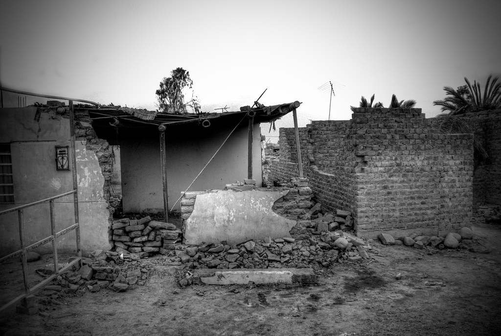
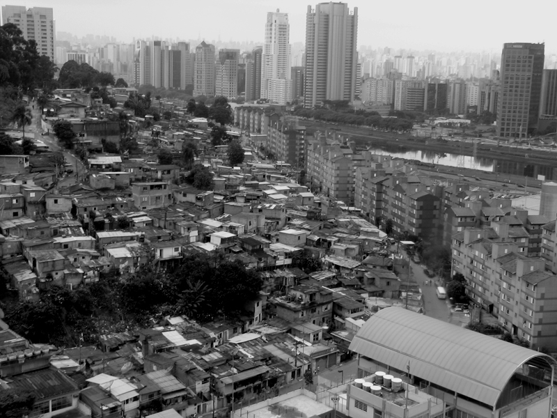
To get an idea of what might fill the void, it might be interesting to see how social space is structured in places where gift economies (or at least barter systems) often already exist and retail strips are few and far between, at least in the traditional sense: slums.
An article from Forbes, mentioned briefly in a previous post at Where, described the socioeconomic situation of many older, established slums in Asia and South America thusly: "Many slum dwellers are in fact entrepreneurs, albeit writ very small. They recycle trash, sell vegetables, do laundry. Some even run tiny restaurants and bars for their neighbors." So while there are no Ginza Districts in the favelas of Rio, there is a social commerce to such places. Restaurants and bars remain important components of the neighborhood, which makes good sense; people have always come together over food and drink, and will continue to do so regardless of any freak evaporations of the retail sector.
Another thing that brings people together is knowledge -- or, more specifically, the exchange thereof. Another recent post covered McGill University's Edible Cities project in Kampala; the site for the students' project "includes a low-lying wetland area...where a youth cooperative practices brick-makings, providing work for otherwise unemployed youth...and a sloping dryland area where farming is [practiced]." While this is a very rural area being discussed (albeit in the context of a larger city), the Kampala site illustrates two more possible uses for a retail-less streetscapes: public workshops (which could cover a variety of topics in addition to brickmaking) and storefront hydroponic community gardens.
Heh.
If the second option seems somewhat far-fetched, the first is hardly at all; in fact, in the face of looming irrelevance in the digital age, libraries around the world are starting to take on a more social role in their respective cities, staging various events and programs to encourage public discourse and teach skills that cannot be learned with a mouse and keyboard. One of the most innovative library programs that I've heard of recently is in Medellín, the second city of Colombia.
Once the so-called Kidnappping Capital of the World, Medellín has made more news recently for building five spectacular modernist libraries (like the one in Santo Domingo Savio, pictured above) in its most impoverished barrios. One of the programs to utilize these new libraries -- which are equipped with computer labs full of brand spankin' new computers -- is HiperBarrio, which teaches teens in the barrios how to use blogging and other social media tools as a creative outlet for self-expression. Juliana Rincon, one of the founders of HiperBarrio, spoke of the program's inspirataion in a recent interview with Global Voices Online, saying, "It was amazing...telling these kids about blogs and finding out that they had no idea that there was something like a blog, that they existed. [Or even] that you could write online and have a virtual space to keep your writing, the videos you like, and pictures." Libraries, in this case, serve not just as containers for information, but as catalysts for the creation of new information and new ideas. Certainly, this kind of social space, the place of public learning, will play an increasingly important role in cities as we continue through the Information Age.
Whatever we come up with to fill storefronts and social spaces, shopping districts and neighborhood retail strips are unlikely to disappear within the lifetime of anyone reading this blog post. Still, imagining a world without retail can tell us a lot about how we use cities, why we do things the way that we do, and how we can improve urban places without courting Starbucks and Barnes & Noble for civic salvation. In fact, picturing your neighborhood without any shops selling anything other than necessities might be a great way to fall in love with the place all over again. That is, of course, assuming that you love your neighborhood -- and that you don't live off Rodeo Drive.
----------
That's all for now, folks. Best of luck to everyone in 2009. Let's hope it's not as bad as we're all worried it's going to be.

(Photo from Flickr user galitagreeneyes. The original full-sized color version can be viewed by clicking the photo.)