Showing posts with label strange places. Show all posts

Monday, February 9, 2009

Think Big. Freak Out.

Daniel Burnham's line "Make no little plans; they have no magic to stir men's blood" is probably one of the most famous quotes to come out of the field of urbanism. It's also one of the most thoroughly abused. Burnham's maxim about aiming high is used by proponents of megaprojects like Atlantic Yards (the poster child for megaprojects, you see) in defense of superblocks and devastatingly overbearing towers. In truth, Burnham did not stop where the quote does. The quote is almost always truncated, cutting off much of the great planner's intent. The full quote reads:

Make no little plans. They have no magic to stir men's blood and probably themselves will not be realized. Make big plans; aim high in hope and work, remembering that a noble, logical diagram once recorded will never die, but long after we are gone will be a living thing, asserting itself with ever-growing insistency. Remember that our sons and grandsons are going to do things that would stagger us. Let your watchword be order and your beacon beauty. Think big. (via)


The idea of a noble, logical plan becoming a living thing is about as far from the logic of the contemporary commercial megaproject as you can get. Giant developments that have become commonplace in cities like New York, London, and Chicago over the past two decades are designed to eliminate risk, to minimize mess. They are, in a word, sterile. Burnham was talking about creating plans that are dynamic, and that improve their surroundings, not wall themselves off from them.

So if it's not the four-tower 3,000-condo 250,000 square-feet-of-retail megacomplex, what does a grand plan look like? What can we do to stir mens' blood, to re-engage the many millions of people who have become disconnected from the urban environment, who have willfully or accidentally removed themselves from the discourse? In the face of increasingly grave problems, how can citizens be energized to turn their cities into the viridian green, environmentally-restorative engines that we have heard so many advocates call for them to be?

There are no small changes that need to be made. I refuse to parrot, any longer, the absurd myth that changing your lightbulbs or using a fabric bag to pick up groceries will save the world. The words "hogswaddle" and "poppycock" come to mind (apparently climate challenge turns me into a Dickensian lower-class Brit). It's true that these things add up, but public opinion on fighting climate challenge is waning; people are growing tired of the issue. The public is, of course, fickle, so this should come as no surprise. The bite-size formula is not going to work. The ante must be upped.

For planners, architects, and urbanists, this necessitates a call for big plans. We need so many more Burnhamian Big Ideas. It's time to re-think infrastructure, and architecture, and every tiny component of every city. All things can be re-imagined; we're starting to see these kinds of big ideas in playful fits and starts. Defunct airports can become magnificent tree-covered mountains; parks can be used as psychological and environmental rehabilitation centers; whole cities can become stand-in icebergs; we could build rivers in the sky, and fill them with floating classroom-ferries. Nothing about our cities is set in stone -- not even their geography. And as nature starts to change our cities in new ways, we need to re-think how our cities interact with nature.

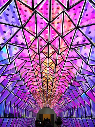
Perhaps the greatest piece of infrastructure that cities have at their disposal, in terms of reimagining and regenerating the cityscape, is often also the last remembered. People -- the citizens that use the city, kick it, punch it, pull it down and lift it up a hundred million ways each day -- are brimming with ideas about how to make their cities better. The images in this post, for example, are from a collection of entries to a public call for the reinvention of Coney Island. This is the crazy shit that people come up with; it follows that what they want to start seeing more of, in addition to genuine, solid plans for making cities work better, is some freaky, crazy shit.

Here's a proposal; the seed of a big idea, perhaps: let loose. Think about the most unchangeable features of your city, and try to imagine them changed. Don't just daydream; come up with Big Ideas, grand plans for revolutionizing the way that your city works. Get crazy, and put down on paper the ideas you wouldn't dream of bringing up in a meeting at work. Then upload them and share them with everyone who has a computer and a set of working eyes. We need more sky rivers, more radical civic interventions, and more acid-trip theme parks. More than ever, we need very, very Big Ideas. And if we try hard enough, if we come up with enough crazy shit, maybe we'll be able to shock more people into caring about how their city works, and what it looks like. No one cares if you tell them the airport is being turned into condos and a dog park. Heads turn when you suggest that it be geo-engineered into an urban Matterhorn. It doesn't have to happen. It just has to get people to pay attention.

Burnham wisely noted that each generation's sons and grandsons would do things that would stagger their forebears. Make your grandparents proud; go freak out on your city.


(Photo from MASNYC's Flickr gallery.)

Monday, November 17, 2008

The Next, Next Street Art

Street With A View is a performance/digital art hybrid (I know! So rad!) coordinated by a small team of artists, residents of Pittsburgh's North Side, and Google. The artists thought up the idea to create vignettes in the city's streets that would be coordinated with when Google's Street View camera car would drive down those same streets. They tapped local residents to act out a series of scenes, coordinated with the Googleheads, and the rest is history.

SWAV's staged "interventions," as the team refers to them, point out an interesting possibility for street art. Referring to an earlier post on the subject, tech like RFID chips and barcodes will make digital graffiti a more ready possibility in the future. SWAV highlights one of the many ways that this type of art could be achieved: take a 360˚ photo (of which there are plenty freely available through Street View for an enterprising hacker), doctor it, and attach it to an RFID chip installed inconspicuously nearby. Set it up with an automatic trigger, and any passersby with an iPhone or a Blackberry will be treated to an alternate reality version of the place that they're walking through.

Aside from the potential for humor, there is political potential here as well. Think of preservationists looking to impress upon people the importance of preventing the destruction of historic structures; take the current, well-publicized battle over St. Vincent's in Manhattan, for example. A skilled digital artist with a penchant for quirky 1960s-vintage low-rises could create a digital, 360˚ recreation of the intersection of 7th Ave and 12th Street in which to-scale renderings of the 300 and 233 foot towers planned by the adjacent hospital replaced the distinctive O’Toole Medical Services Building. Passersby could get a better sense of the scale and blandness of the new development than they ever could from a wallet-sized picture in the Times.

Inverting the perspective, SWAV says some interesting things about Google's Street View feature as well. When examining the interventions on the Google Maps website, try to imagine what a normal user, unaware of the SWAV project, might think when encountering the digital parade. At the same time that it makes Google Street View more fantastical, SWAV also makes it, in a way, seem a bit more real. Certainly moreso in examples like the moving truck or the garage band practice. Add to that the impromptu "meta-interventions" staged by locals unaware of the project until it was happening, and the lines between reality and digital representation get delightfully blurry.

To ponder: If people become more aware of the Google Street View camera car and scenes like those staged by SWAV become more common (which seems very plausible, I think), what role does the Street View feature take on? Its parallel reality becomes heightened; humor and politics are woven into the scenery, and become as valid as the built environment that the feature was intended to represent. In addition, what does a more theatrical representation on the web mean for the real place being represented? If one were to walk down Sampsonia Way in Pittsburgh -- a charmingly "Pittsburgh" kind of street -- would it seem boring? Less authentic or interesting than its Street Views counterpart? Does the digital city draw from the real city, or add to it?


(Photo from Street With a View. The original full-sized color version can be viewed by clicking the photo.)

Thursday, July 24, 2008

The Worst Cities...?

While Monocle and Forbes and everyone else in the mainstream media argues about what cities are the best to live in, Where was recently introduced to a site that's coming at urbanism from a slightly different perspective. Worst-City.com is home to what appears to be an entirely subjective (and often absurd) list of the sixty worst cities to live in on the face of the earth. The intro paints a pretty accurate picture of what to expect from the rest of the site:

"The world is very, very, very big. There are some wonderful places on its surface. Fabulous sun-kissed beaches with miles of golden sands. Wonderful mountains with crystal steams cascading down into tropical paradises. There are also some horrendous cities populated by a subculture of thugs and gangsters. Sadly this website is about the latter locations. Here you will discover some of the most vile and violent places to leave. So read on and be prepared to be shocked."

The list ranges from the obvious (Chernobyl, Brazzaville, Baghdad) to the completely befuddling (Paris, Seattle, Barcelona), and takes a whack at everything from Milwaukee to Bangkok in between. The site is filled with bons mots like "When it was built most Parisians hated the Eiffel Tour - that's why they named it Eiffel - means Awful in French!" and is entertaining as long as it's read with several large grains of salt and a hefty suspension of disbelief. All in all, it's a mind-bending international adventure that's worth a lazy afternoon.

Enjoy the ride...

Sunday, April 27, 2008

The Linkdump

Weekend Reading has been on hiatus, along with the rest of this blog, for the past three weeks. That was unfortunate, as there was a ton of great reading material online during that time. If you find yourself with some reading time over the next few days, check out some of the following posts and articles.

The art and architecture of arcologies || Lessons from those who've never seen a city || A note to the Midwest: Change or Die || Four artistic ruminations On Cities || Digital Nomads: the podcast interview || Amazing Title Award goes to "Growing Pains for a Deep-Sea Home Built of Subway Cars" || Stepsister cities: not always ugly, but usually forgotten || Tatlin's Tower as archetype || Beautiful drawings of Buenos Aires' architecture || Nigel Coates takes the stage in Milan (Yay! Where loves Nigel Coates!) || Manaugh presents erudite posts on noise pollution, cloud writing, and video game architecture || Justin Davidson on Nouvel's brillaint 53 W 53rd || A fascinating look at Sao Paulo's growing (!) traffic problem || Four conditions for exuberant diversity || When architecture is freer than the people who use it || Baghdad: feral metropolis on the dunes || Why homeownership may not be the best option || Coolest green building ever || The Earth is making music (Incredible) || Rich Florida on The Big Sort || Phototour of a "constructive riot" || A wiki route planner for urban explorers || The chronicles of an adventuresome boulder || If you still need more proof that cities are living things, look no further... || Dubai's Palm runs into big problems (Raise your hand if you're surprised) || The Bowery Boys explore the history of NYC as a video game setting || An example of "new urban hieroglyphics" || How urban nomads are changing architecture || Design as economic salvation in BsAs


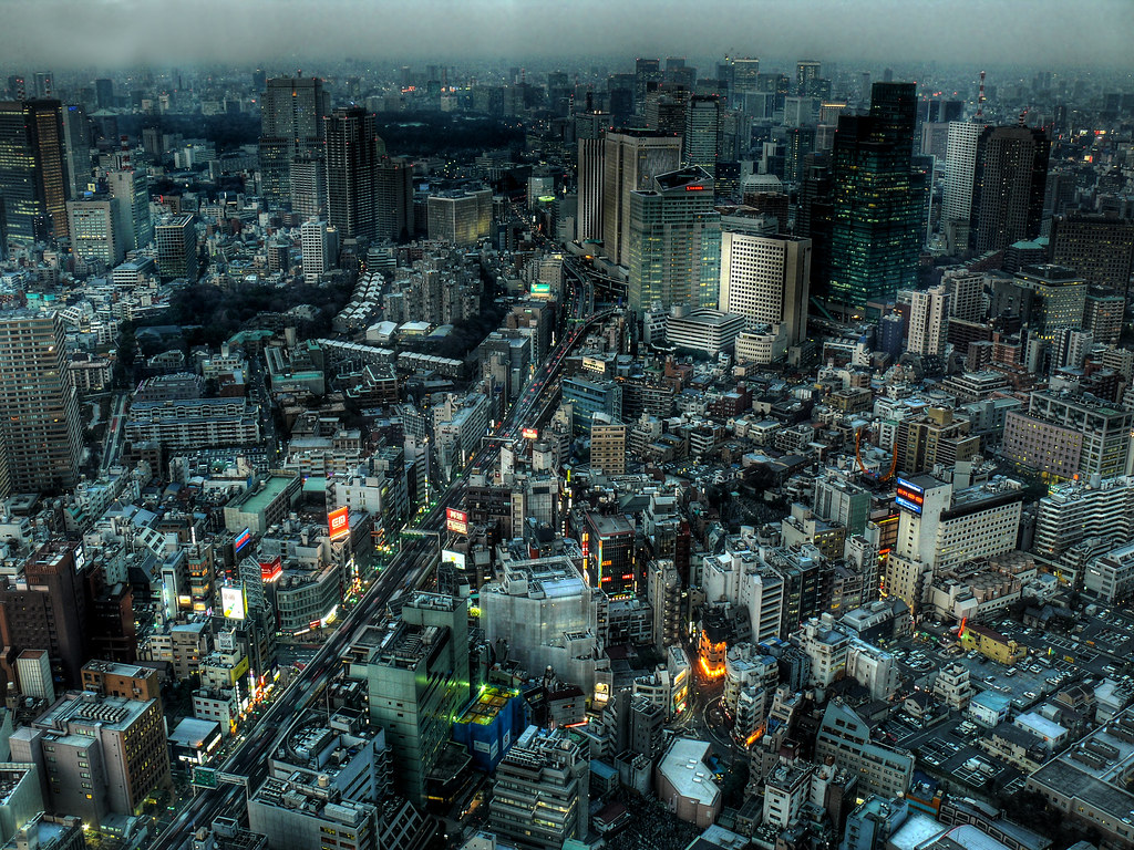
(Photo from FFFFOUND! The original full-color version can be viewed by clicking the photo.)

Friday, March 28, 2008

WEEKEND READING: March 22-28, 2008

Sorry for the slow week. Regular posting should resume after this weekend. In the meantime, there's always plenty of weekend reading to go around!

ITEM ONE: First off, a bit of self-promotion. I have a new post up at Next American City projecting some possible outcomes of the rise of online virtual worlds and increased advertising in Western culture. The French Quarter as an export? Perhaps...

ITEM TWO: WorldChanging with a stirring piece on the powerful political act of optimisim.

ITEM THREE: Is your city a "Paris" or a "London"? Read this Economist piece comparing the two euro-glam-capitals and ponder that question for a bit. (Via Pittsblog)

ITEM FOUR: PlannersWeb takes an in-depth look at the role of urban planners in a Chavez-led Venezuela.

ITEM FIVE: Core77 reports on the book containing the radical designs generated by participants in eVolo's '06, '07, and '08 Skyscraper Competition. Flashy stuff. (Photo credit)

ITEM SIX: Speaking of radical architecture, Richard Florida posted news of a massive floating city-cum-cruise ship. This definitely falls under "You gotta see it to believe it."

ITEM SEVEN: Over at Interchange, Barbara Faga looks at the somewhat comical tug-of-war in public perception of which is worse: density or sprawl.

Hasta luego; enjoy your weekend.

Friday, December 7, 2007

WEEKEND READING: December 1-7, 2007

Back to business as usual this week for Weekend Reading. Thanks again to Colin for taking over during November, and thanks once more to all of the guest bloggers who helped to keep Where chugging along during NaNoWriMo!

ITEM ONE: It's BLYGAD 2.0! Tumble Like You Give a Damn, folks.

ITEM TWO: The Architectural League of New York has put out a call for entries to its Young Architects Forum competition for 2008.

ITEM THREE: In the past, little attention was paid to South America and its blossoming cultural scene. Not much has changed, there, but Line of Sight dug up a great article from a 1916 New York Times on the subject.

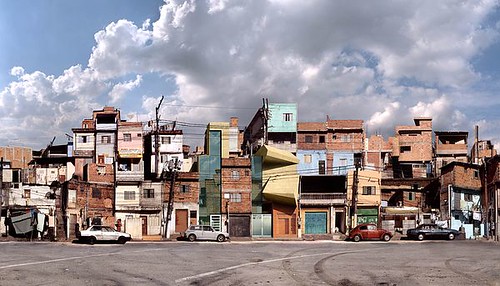
ITEM FOUR: Subtopia has a post called "Squatter Imaginaries" that contains some of the coolest images you'll ever see. (photo credit)

ITEM FIVE: Giant scale model of a partially destroyed downtown = kickass display for your living room.

ITEM SIX: The Future of Cities on what Jane Jacobs might have thought of Facebook.

ITEM SEVEN: Things Mag starts a recent post off with some interesting ruminations on destruction and redevelopment in the UK. Much link love follows.


'Till next week, happy surfing.

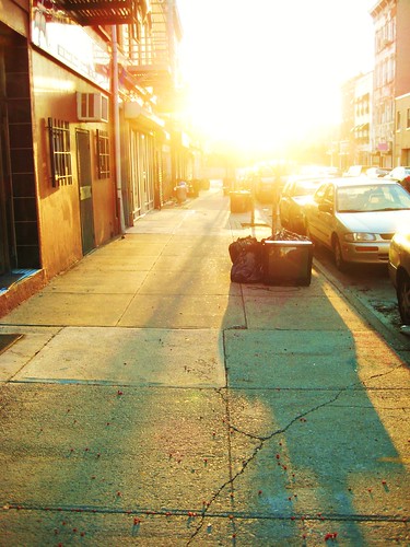
(Photo from Flickr user shadeofmelon. The original full-color version can be viewed by clicking the photo.)

Monday, November 19, 2007

Airoots Gets Lost in Deep Urbanmess (Guest Post by Matias Sendoa Echanove and Rahul Srivastava)

We arrive at a narrow commercial street lost somewhere between Bombay and Tokyo. It is crowded with pedestrians, bicycles, street vendors, food stalls, and wandering cows and dogs that don’t allow cars to pass through. Most of the buildings lining the street are two to three stories high, covered either with faded, dusty shop-signs painted in art-deco fonts, or snazzy neon lights. Billboards with smiling Manga faces and Bollywood movie stars eye each other warily.

An intricate web of wires, pipes, pathways, and cables connect the buildings, huts, cottages and shop-fronts to each other. They hang overhead or lie snugly underground. They are like masses of snakes intertwined into each other – alive and organic. They buzz with whispering voices, crackle with coded e-mails and crisp exchange of smses, gurgle with water or sewage and are swollen with pornographic images looking for immediate release, along with religious icons that appear on screens of high-tech devotees who bow to them in tiny studios.

The air is abuzz with invisible energy fields. Wireless networks that feed on cables and transmit the cyber-world into this dense neighbourhood. They compete for airspace with the smells of food, fish, gutters, and incense and the crowded sounds of the city.


Walking through the gulleys and streets one sees second-hand electronic shops selling tiny bits of chips and wires. We bump into a bull, resting in front of a poster selling Chinese medicine. Withdrawing, we stumble over a robot-dog who yelps angrily, snapping mechanically and uselessly at our ankles.

Going deeper one sees nimble hands stripping off circuit-board wires. They magically transform the pieces into copper jewelry that is marketed as tribal art. On one side otakus and geeks wait to devour cheap electronic left-overs – on the other, hippies and high-fashion lovers wait to decorate themselves with re-designed electronic waste.

An entrance to one street looks particularly crowded. It is lined with Japanese tea-shops, Iranian Samovar-houses and Chai-stalls served by kids. Old men and women sip tea, keeping an eye on children playing dangerously close to railway tracks. The street shudders as two trains zoom pass each other – one a yellow and brown old-fashioned rusty local train with open doors and another a sleek silver, futuristic machine made of steel, its windows covered with dark tinted glass.


The sound of new stalls being put up and old ones being pulled down rent the air. A bearded man with wild eyes sells mangas in a makeshift stall right next to an old sadhu with dirty, matted hair, who tells your fortune. The mangaman reads out stories to a group of teenaged girls who giggle crazily as he shows them explicit pictures. The palmist-cum-astrologer catches a hapless European tourist and predicts that he will hook up with one of the teenaged girls, who is already smiling at him.

The two connect and vanish around the corner hand in hand. To be continued...


(All of the images above are photoshop collages of Bombay and Tokyo.)

------------------


Big thanks to today's guest bloggers! Matias Sendoa Echanove and Rahul Srivastava are the bloggers behind Airoots/Eirut. Check out their blog for more ruminations on "adventitious roots, urban forests & villages, natural cities, lost tribes, new nomads, and everything in between."

Sunday, November 4, 2007

Maps: Finding Our Place In the World @ The Field Museum

About a fifth of the way through the Field Museum's Maps exhibit, I started to feel a bit giddy. As a long-time lover of maps, I'd been looking forward to this -- the centerpiece of Chicago's Festival of Maps -- for months, and it was clear early in my time at the exhibit that I knew that I would not be disappointed. Now, after having a day to reflect, I can honestly (and emphatically) say that Maps: Finding Our Place in the World is one of the most impressive museum exhibits I have ever attended.

Those are strong words, I know, so let that be my one burst of enthusiasm. Henceforth, I'll try to be as objective as possible...I'd hate to do that thing where I puff something up so much that it can't live up to my description. Not that I think it's possible to overstate -- oops, sorry. Almost gushed again.

Divided into seven sections, Maps begins by addressing what is probably the most common use of its subject matter: wayfinding. The content of this section is subdivided into two groups, the Itinerary (one route depicted) and the Network (many routes depicted together). The maps on display set the tone for the rest of the exhibit; there is a great variety of mediums, styles, and time periods represented. Highlights include a section of an ancient 60-foot Japanese scroll depicting the road from Kyoto to Edo (now Tokyo), a 1940s road map of America with road trip routes taken by an anonymous family highlighted and annotated, and an original print of Harry Beck's revolutionary redesign of the London Tube map.

The second section of the exhibit displays maps that give structure to the world. While many maps may not be used directly for getting from A to B, they help us to develop a concept of the vastness of the world around us. The exhibit charts the evolution of mankind's understanding of the planet through maps, showing how they were used to record progress and redefine the world as our knowledge grew. The undisputed centerpiece of this area is a set of two large (about 4 feet in diameter, but I'm guessing) wooden globes -- one that depicts the earth as it was believed by cartographers to look (curiosities include the island of California off of North America's west coast and the near-absence of Australia and New Zealand, though overall it's surprisingly accurate) and the other showing the celestial dome above, with full-color representations (i.e. a scorpion for Scorpio) of the constellations.

Maps are also used, as shown in the third and fourth sections of the exhibit, to show important places and "bear witness to and shape history," in the curators' words. These two collections expand quite nicely upon the logic of the first two; the most obvious uses of maps are to chart the world and the routes that people use to move around it, but with a heightened understanding of the larger world, it makes sense that people started using maps to break the larger world down into smaller parts. Privatization and land division become central foci here. Several important names pop up up in a subset of the fourth section focusing on historical maps of the US: Lewis and Clark's map of their route is here, as are land surveys by George Washington, Thomas Jefferson, Abraham Lincoln, and Benjamin Franklin.

Even more sophisticated maps make up the fifth section, which highlights maps that make the invisible visible. These are highly detailed creations that detail intangible or hidden details about places. One of Jane Adams Hull House's famous maps of Chicago blocks broken down (and color-coded) by ethnicity and income is on display (a print of the same map is included in the Chicago History Museum's Mapping Chicago exhibit). So is a huge, vividly-colored map of the geology of Great Britain, one of the first maps of its kind. Another first here is a small, unassuming map of northern Italy that is believed to be one of the first uses of shading to depict topography, pre-dating its common use in recent times by several centuries. A closer look at the plaque describing this piece reveals that its creator was none other than Leonardo da Vinci. Another of his quiet pieces, a plan to canal-ize the Arno, is nearby.

The sixth area is a showcase of maps that depict imaginary places. L. Frank Baum's map of Oz is here, along with several of J.R.R. Tolkien's hand-drawn maps of Middle Earth. This section contrasts nicely with the seventh, which shows maps in rather mundane use in everyday life. A RISK board, a needlepoint map of Great Britain, a kiosk showing mapping technology on modern cell phones -- these examples point out the many ways in which maps seep into our daily routines. This last section culminates in an interactive wall of video maps where you can touch cursors on large screens and navigate satellite imagery and zoom in on your hometown. (It can be a bit tricky to get these to work -- try holding your fingers a few centimeters away from the screen).

If there is one opportunity that is really missed here, it's that Maps does not spend any time on the way that the internet is currently democratizing the field of cartography. There is no mention of mashups or group maps or even Mapquest, the launch of which really was revolutionary moment for mapping technology (though Mapquest's prominence in online mapping has since been usurped by Google and Microsoft). In fact, I kept expecting to see this theme threaded throughout the other sections of the exhibit, but it never even made an appearance.

Overall, Maps: Finding Our Place in the World is a suitably rich and creamy center to the FoM's gourmet chocolate. It's an exhibit that keeps you moving, looking forward to the next map even before you've finished reading about the last. If you don't live in the area but you've been looking for a reason to visit Chicago, this exhibit would even make a good excuse to come. If you live within driving distance and have even a passing or newfound interest in cartography, you have no excuse not to make the trip.

IF YOU GO
Maps: Finding Our Place in the World is on display at the Field Museum until January 27th, 2008. The museum is open 9:00am-4:30pm, seven days a week; the entry fee for the museum and the special exhibit is $19 for adults, $14 for students and seniors, and $9 for children under 12.


Links:
Maps: Finding Our Place in the World (Field Museum of Natural History)

Saturday, October 13, 2007

Infill


This is just too cool.

(Photo found via FFFFOUND.)

Friday, September 28, 2007

WEEKEND READING: September 22-28, 2007

Lots of good reading for this weekend. Don't miss Item Six if you're a fan of absurd humor.

ITEM ONE: Deputy Dog (photo credit) went all out on this post about where different vehicles go once they are decomissioned. Kind of makes me wonder if there's a forest of defunct CTA train cars somewhere in Chicagoland...

ITEM TWO: According to APTA, "when compared to other household actions that limit carbon dioxide (CO2), taking public transportation can be more than ten times [more effective] in reducing this greenhouse gas."

ITEM THREE: I *heart* Jane Jacobs, but I really strongly do not *heart* how her message has been co-opted and bastardized over the years. This wonderful and succinct piece from New York magazine sets the record straight. (Found via Neighbors Project's excellent daily Neighbor News report -- a must-read for anyone interested in gentrification!)

ITEM FOUR: A trust fund for affordable housing, first proposed in the 1980s, may finally be on its way to becoming a reality. (Here are some more good ideas about the subject).

ITEM FIVE: Wendy Waters speculates about an urban baby boom over at All About Cities.

ITEM SIX: Some guerilla urban art on the CTA trains that'll give you a good laugh. Cut, paste, and try it in your city. The more ridiculous, the better!

ITEM SEVEN: Can Second Life actually improve real-world physical environments? Here's the first compelling argument I've read that says "yes."

Have a great weekend!

(Photo from Flickr user shadeofmelon.)